
Showing that it Matters: Mapping the George Floyd or Black Lives Matter Protests
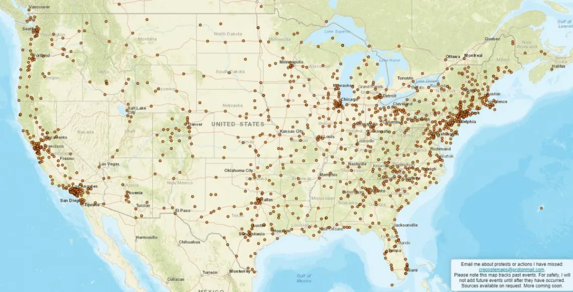
Alex Smith Alumnus from the MS-GIST Program 2015 is supporting the George Floyd or Black Lives Matter protests by highlighting their extent using Esri's ArcGIS Online. "I am a GIS analyst in Tucson who is mapping every city or town I can find that has held a George Floyd/Black Lives Matter protest, action, or vigil. Currently, as of Saturday, June 6, I have 1,689 cities or towns mapped, mostly in the United States. The breadth of communities having actions is incredible, and the more I search, the more I find, even in the tiniest, most rural communities. I started this project because once the scope of this movement became obvious, I realized a comprehensive map of the communities involved would send a powerful message of how the conventional narrative of the red-blue, rural-urban political and social split in our country is a massive oversimplification. There are people everywhere supporting Black Lives Matter, and it's astonishing and inspiring to map." https://www.creosotemaps.com/blm2020/